
SOLUTION
Public safety
A rapid situational awareness based on aviation data allows for effective response to emergency missions such as wildfire detection and nighttime surveillance.
Key Benefits of Public Safety
-
01Rapid Emergency ResponseQuickly detecting emergency situations allows for prompt initial response, aiding in safety.
-
02Information Collection and AnalysisEquipped with high-resolution and thermal cameras, drones can swiftly and accurately assess the location and scale of fires.
-
03Surveillance ToolDrones serve as crucial tools for surveillance teams, ensuring safety and enabling faster responses.
Use Case
-
01 Fire Monitoring and Crime Prevention at Busan UniversityFire Monitoring and Crime Prevention (Featured Video - Rainbow)When relying solely on CCTV or security personnel, surveillance coverage may be limited. Especially in large areas, it can be difficult to effectively monitor hard-to-reach areas. During nighttime patrols, it becomes challenging to accurately detect objects or activities within the field of view, resulting in delayed responses to crime or safety issues.Utilizing Drones for Fire Monitoring and Crime Prevention (Featured Video - White Hot)By using thermal cameras, drones can detect fires or crimes from afar. This helps overcome blind spots of CCTV and accurately identifies crime scenes or fire locations.
-
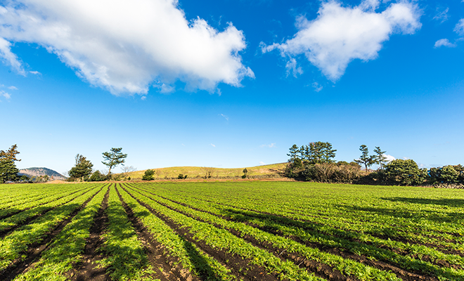
02 Precision Agriculture: Vegetation Index Generation#NDVI #CIR #NDRE #ChlorophyIIMap #OSAVI #DSM
 ·Understanding Vegetation Index in Forestry/AgricultureIn precision agriculture, using vegetation indices (such as NDVI) with drones allows for monitoring the health of crops and early detection of diseases. This enables proactive measures to be taken, ultimately maintaining or increasing crop yields and increasing farm income.
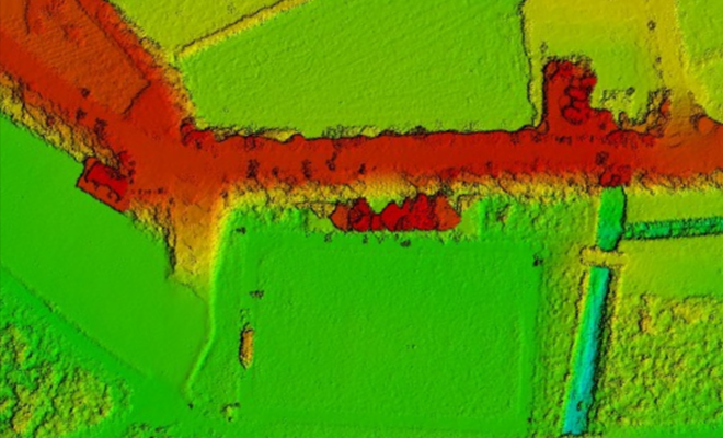 ·Utilizing Drones for Forestry/Agriculture Vegetation Index AssessmentTo generate vegetation indices, multispectral sensors and infrared cameras are utilized. Multispectral sensors detect light of various wavelengths, which is useful for assessing the health of plants. Processed data is used to create maps and visually identify differences in vegetation indices across different regions. The results are interpreted to evaluate crop health, growth patterns, etc., and necessary actions are taken accordingly.
 -
03 DFR (Drone First Responder)·Drone First ResponderDFR plays a vital role in surveillance operations and emergency services by providing high flexibility and efficiency in emergency situations.
Equipped with various sensors and cameras, it can collect diverse information from the air. The collected data supports swift and effective responses in emergency situations, minimizing casualties and property damage.·Controlling Disaster Scenes via DFRUsing speakers and searchlights mounted on drones, on-site control is possible before emergency vehicles arrive. Utilizing cameras such as thermal imaging and multispectral before the on-site response team arrives enables rapid assessment of the situation and supports planning in challenging disaster environments. -


Related Products
·Public Safety Solution Platform
AQUILA-2
Equipped with a thermal imaging camera for identifying fires, allowing real-time monitoring and enabling quicker response in the event of wildfires or emergencies.
•Payload and Station
-
-
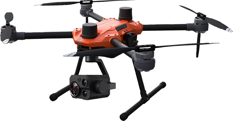
 ZT30
ZT30 -
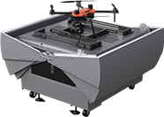 CUNA2 (optional)It is an efficient solution for repetitive flights scheduled at specific intervals, as it is a fixed station continuously placed in one location
-
AQUILA-2
Equipped with a thermal imaging camera for identifying fires, allowing real-time monitoring and enabling quicker response in the event of wildfires or emergencies.
•Payload and Station
-
-
ZT30
-
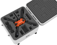 PORTUS-P (optional)A portable station that combines a drone storage case with a mobile station. It is convenient to move around, allowing the station to be deployed and operated anytime, anywhere.
-